
Southern Stretch: San Diego to Los Angeles
The southern end of PCH is urban, wide, and surprisingly breezy. From San Diego County, the highway threads through surf towns like Encinitas and Cardiff-by-the-Sea before pushing into the greater LA sprawl. Expect traffic - especially around Malibu on weekends - but don't write it off. This segment delivers easy beach access, a laid-back Southern California vibe, and some genuinely striking oceanfront bluffs around Torrey Pines State Natural Reserve.
Malibu itself deserves more than a drive-through glance. The stretch from Pacific Palisades to Point Mugu packs in craggy coves, celebrity-owned beachfronts visible from public lots, and the rugged backdrop of the Santa Monica Mountains. It's also one of the only segments where you can comfortably stop for a sit-down lunch without planning hours ahead.
| Total approximate length | Over 600 miles (San Diego to Leggett, CA) (Caltrans route documentation) |
| Primary designation | California State Route 1 |
| Most landslide-prone segment | Big Sur (periodic closures possible) (Caltrans road conditions reports) |
| Fastest full-drive estimate | Approximately 10-12 hours without stops |
| Recommended travel pace | 3-5 days for a meaningful experience |
| Cell coverage reliability | Spotty to nonexistent through Big Sur |
Central Coast: LA to San Luis Obispo
North of Malibu, the highway passes through Ventura and Santa Barbara - two cities that reward a slow stop over a hurried drive-through. Santa Barbara's stretch of coast is relaxed and walkable, with a palm-lined waterfront and mountains rising directly behind downtown. Beyond the city, the highway hugs the ocean through Gaviota and opens onto a quieter, ranching-flavored landscape that feels noticeably less crowded.
The segment around Pismo Beach and San Luis Obispo County shifts the texture again. Iconic sand dunes appear at Oceano, wildflowers blanket the hills in spring, and the pace slows considerably. This is a practical overnight zone - accommodation is more affordable here than in Big Sur - and a strong base for exploring Hearst Castle to the north.
Big Sur: The Icon in the Middle
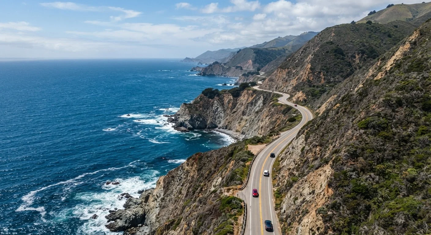
No honest PCH breakdown can understate what Big Sur actually is: one of the most stunning coastal drives on the continent, and also one of the least convenient. Gas stations are scarce, restaurants are few, and cell service essentially vanishes for long stretches. That's part of the point.
Bixby Creek Bridge is the postcard image, but the real reward is sustained - miles of vertical sea cliffs, redwood groves just off the road, hidden waterfalls, and the McWay Falls overlook at Julia Pfeiffer Burns State Park, where an 80-foot waterfall drops straight onto the beach below. Allow a full day minimum for this segment. Rushing Big Sur is a mistake most drivers regret immediately.
Check Road Conditions Before You Go
Big Sur and parts of the Sonoma-Mendocino coast are prone to landslides and storm damage, which can close segments of Route 1 for days or even months. Always check Caltrans QuickMap or the official California DOT site for current conditions before setting out. Cell service is unreliable through much of the route, so download offline maps in advance.
Northern California: Carmel to Leggett
North of Carmel, Route 1 passes through the Monterey Peninsula - 17-Mile Drive is technically a private toll road and a detour, but Monterey itself sits right on the highway and the aquarium there is among the country's best. Pacific Grove and Carmel-by-the-Sea are walkable, charming, and worth lingering in if you have a spare afternoon.
Further north, the highway runs through the wine country coast around Bodega Bay and the Sonoma coast - a stretch that trades drama for a softer, greener beauty. Fog is frequent here, especially in summer mornings, and the towns are smaller and farther apart. At Leggett, Route 1 officially ends by merging into US-101. The northernmost California coastal stretches reward travelers specifically seeking solitude over scenery-per-mile efficiency.
600+
Miles of California coastline on PCH
The full route from San Diego County to Leggett spans well over 600 miles of varied Pacific shoreline.
~90
Miles of Big Sur's roadway
The Big Sur segment alone covers roughly 90 miles of some of the most rugged and remote coastal terrain in the lower 48 states.
1937
Year the Big Sur segment opened
The Carmel-to-San Simeon section of Route 1 opened in 1937 after nearly 18 years of construction through challenging terrain.